Places, Earth
San Francisco, 2022
San Francisco, 2022
|
|
Places, Earth
San Francisco, 2022 |
|
|
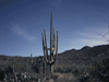
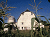
When I first met my wife, she felt we needed to be together every minute and had a long bucket list of places to visit, including San Francisco. Twenty years later, here I am on my way to San Francisco accompanied only by Francine, my 21 year old station wagon. My wife is home with her dogs. I kissed my cat and hugged my wife and was off. I headed north from Los Angeles on I-5. When the reception of the Classical radio station ran out, I switched to a CD by the late Nancy Griffith while observing the rolling golden hills of California (reference Kate Wolf). I crossed into Kern County, made a quick stop at Tejon Pass Safety Rest Area, and descended the Grapevine into the majestic San Joaquin Valley. I stayed right to go left at the I-5 / Highway 99 split. I cruised north on I-5 past fields and orchards. Most of the world's almonds come from here. I skipped Buttonwillow Rest Area and cruised north. The farms and utility poles passed by as the CD changer switched to Sons of the San Joaquin. Another quick stop at Coalinga-Avenal Safety Roadside Rest Area. Just north of the Merced County line, the rest area (John Erreca Safety Rest Area) was closed, I had thought I might stop there for lunch. I cruised past Dos Amegos Scenic Overlook of the aqueduct. I passed a Cactus farm. I stopped for gas at Santa Nella where we would have stopped at Peasoup Andersen's for lunch had my wife come along. I continued north, dining on a sandwich. At the I-5 / I-580 split, it is easier to follow I-580 which I did by mistake years earlier. Shortly after I entered Alameda County I hit traffic. The traffic gave me a chance to see the wind turbines of the Altamont Pass. Soon I realized the traffic was to observe a burned car on other side of the highway. Not being familiar with the Bay Area, I had a bit of anxiety the rest of the way. Finally, after a bit less than 7 hours, I was standing next to Fort Point National Historic Site looking at Alcatraz, the Golden Gate Bridge, and downtown San Francisco. I spent about an hour and a half wandering around the three levels and roof of the old fort that once protected the harbor entrance. The fort, built between 11853 and 1861 contians many displays and many great views of the ocean, ships, coast line, the city, and above and to the north, the famous Golden Gate Bridge. I next tried to visit the Golden Gate Bridge Museum, but couldn't find where to park. I gave up and returned to Battery Cranston-Marcus-Miller, which I had visited the year before. Then it was too windy for my wife, today is was less windy and I explored about half an hour and then moved on. I drove east to Pier 39 and found parking. Pier 39 is a tourist destination just east of Fishermen's Wharf filled with shops and restaurants on two levels. I took photos and bought Mrs. Field's cookies while looking for Lefty's, a left handed store, where I bought a pruner and tape measure. Next I got Jambalaya to go at Bubba Gump's and explored more while waiting. On the west side of the pier are places for seal to haul out and there were dozens of seals resting on the platforms. Across the way is SS Jeremiah O'Brien, a Liberty Ship, now museum, which I hope to visit in a future trip. Eventually I found my car and headed to my hotel driving along the Embarcadero and passing numerous piers. I checked into my hotel, enjoyed the Jambalaya, and went to bed. Day Two - Museums and Stuff The day started well. I got ready, had breakfast, and left about 7:30. The next two hours didn't go so well. I found parking at Mission San Francisco for a few photos I missed last year. Then on to Old Saint Mary's for 9:00 AM Mass but couldn't find parking, so I returned to the Mission. Once I parked many blocks away and walked several blocks, I discovered Mass was over. I should have stayed the first time. Then off to find Saint Patrick Church for the 10:00 AM. I got completely lost by the time I found parking, which turned out to be only two blocks from the church. I was a half hour early, but I needed the rest. After Mass I headed to the Presidio. Once parked, I wandered the area around the Walt Disney Family Museum. It was about an hour before my tickets, so I had time to look around and eat my lunch. A year earlier, after closing time, I had noticed a military museum which is no longer there. I had wanted to visit the Visitor Center to ask about anything remaining of the earlier Spanish Presidio, but it was closed for construction until next month. As a long time Disney fan and a want-to-be theme park designer, I enjoyed the three levels of Disney. The story began centuries ago in France and traced the family and name changes through England to the United States Midwest. The story continues with Walt through various starter jobs, working with ambulances in France in World War I, early artistic endeavors, cartooning, and finally his arrival in Hollywood. It still wasn't clear sailing as he struggled to get established and through legal maneuvers, he lost his first character. There are many wonderful exhibits of animation, live action, and theme parks. One of the early multi-plane animation cameras rises from the basement over the first floor. Toward the end is a beautiful model of early Disneyland and a bit of video where Walt describes his idea of EPCOT, only pieces of which became the theme park of today. I spent almost three hours in the museum and needed a rest by the time I returned to my car. I rested by driving all over San Francisco. I started with driving around the Presidio, an immense area with hiking trails and military facilities. There are many former military buildings, many, like the one containing the Disney Museum, have offices, businesses, future museums andcultural centers. There are old batteries, a bowling center, cemetery, chapels, homes, and hiding somewhere is Lucusfilm. I revisited the batteries I had a visited a year ago when the wind was worse, but it has great views looking the length of the Golden Gate Bridge. It wasn't too hard to find Inspiration Point with more great views, but I tried three road to Battery McKinnon-Stotsenberg, a nineteenth century (1898) Battery, but they were all closed. The Archeological Lab was closed but there were some pieces of Adobe walls and some stone that might be part of the Spanish Presidio, but no one to ask. Eventually I had driven much of the Presidio so I moved on. At this point I was just looking at stuff so didn't pay much attention to the traffic, which at times was bad. I worked my way to Fishermen's Wharf and noticed the Fishermen's and Seamen's Chapel. The sign said no parking except Sunday to visit the Chapel, it was Sunday so I parked, but it was closed. I took a few more photos of the Wharf as I worked my way out. I wanted a closer look as Sutro Tower and on the way found one of my sister's four former apartment building, it is modern looking compared to some. I found the Sutro Tower and photographed it from near the base. It was built decades ago as a communication tower and it appears in the background of many of my photos. Several times as I criss-crossed the city, I observed Waymo cars running around festooned with sensors. I got a few more photos of trolleybusses, something not seen in many other cities. I had one last stop for today. I won't say where because the street is too narrow and the turns too tight to handle high tourist travel like Lombard Street, but there is a street with more and tighter curves. I had driven it theyear before, but forgot to photograph it I returned to my hotel, ate dinner, watched a video, and tried to sort hundreds of photographs. Day Three - Lone Tower I got ready, packed, ate, and checked out. One of the two elevators was broken, so I wanted to load before the other one broke. I arrived at Coit Tower about 7:00 AM and waited for it to open, at 10:00 AM. I photographed the Tower and the view as I waited. I watched the light change as I waited. Then I waited some more. Eventually the doors opened, on the other side from where I was waiting. Even though I had left my two tickets to the elevator at home (including my wife's), I got on anyway. At the top of the elevator are 37 steps, which is about my limit. I spent about fifteen or twenty minutes slowly walking around the observation level several times taking many photographs. To the west is the Golden Gate Bridge in the distance, the Bay Bridge to the east, Pier 39 and Alcatraz to the north, and downtown to the south. In contrast to my foggy day at Fort Point, it was clear to the horizon. Once back at hilltop level, I walked around the base a few times observing and photographing some wonderful murals to California history. At last I was on my way home. I headed east over the Oakland Bay Bridge, resuming my audiobook, cruising east on I-580. I got gas in Livermore. A mile or two after merging with I-5 south, I stopped a few minutes at Larry Combs Safety Roadside Rest Area just south of the San Joaquin / Stanislaus County line in Stanislaus County. It was open but there was evidence of work being done. I powered south on I-5. The south bound John Erreca Safety Rest Area (Merced Co,) rest area was closed as was the north bound two days earlier. A year earlier we had eaten lunch here, now there is nothing but a little debris. The CD changer switched to Sons of the San as I glided south through the San Joaquin Valley. I stopped at Coalinga - Avenal Safety Rest Area and thundered south. Fields, orchards, and even vines slowly passed behind as I gradually climbed out of this immense Valley. I passed a flock of sheep. The highway is lined with signs blaming the governor for the drought and not the climate change championed by the other party. Still, farmers can't grow the food we eat without water. The miles pass by and I skipped Buttonwillow Rest Area as I saw the south end of the Valley slowly looming ahead. Just before the junction with Highway 99, I was marveling at the giant pipes carrying aqueduct water over the mountains and also a few oil pampers reminding me of the other major product of Kern County. Then traffic. I got gas just before climbing the Grapevine. The Sons of the San Joaquin yielded back to the audiobook as the San Joaquin Valley disappeared in my mirrors. There was intermittent traffic the rest of the way home but eventually I arrived home in time to give my cat her dinner. |

|

|

|
| Note:This is not the official site for any of the places shown in Places Earth. Places Earth is not responsible for accuracy of the information. Hours of operations, prices, exhibits, and sometimes locations are subject to change without notice. |
|
Support this Web Site I hope that you find this web site helpful. It started because of my love for Architecture and interest in History and a desire to share my photographs and tales of my adventures. I don't allow paid advertising. This web site is for your benefit and enjoyment and I make no profit on it. For twenty years it has been supported primarily from my regular paycheck as a Set Designer. If you are in the need of a designer, please see my Set Designer portfolio site Set Design Portfolio. |
|
Links |

|
This site maintained by Kenneth A. Larson. Copyright © 2004 - 2023, Kenneth A. Larson. All Rights Reserved. Website content including photographic and graphic images may not be redistributed for use on another website. |

|

|

|